
Severe Weather: Tornado Watch Issued as Rainfall and Flooding Devastate Southeast Texas and Surrounding Areas
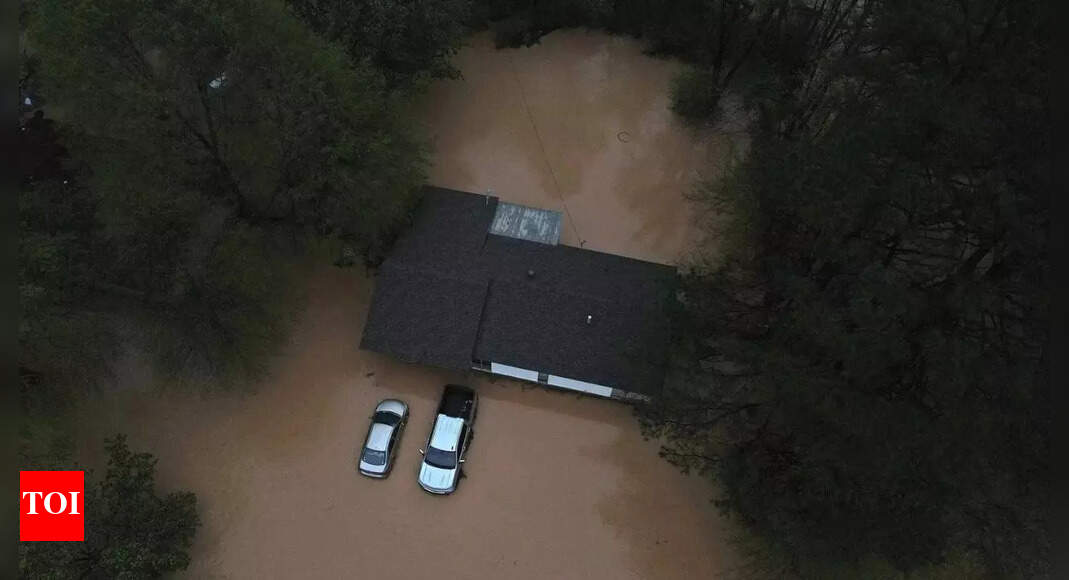
In an alarming turn of events, a Tornado Watch has been issued for much of Southeast Texas until 9 p.m. due to ongoing severe weather conditions characterized by heavy rainfall and flash flooding. This weather system has already wreaked havoc across the South and Midwest, leading to a tragic death toll of 16 individuals and causing significant damage to infrastructure that was already vulnerable from previous storms and tornadoes.
The National Weather Service (NWS) has reported that continuous downpours across the central United States have resulted in rapid increases in water levels, prompting multiple flash flood emergencies from Texas all the way to Ohio. Meteorologists are warning that numerous locations across several states could soon reach what is termed the "major flood stage," which poses a serious threat of substantial damage to roads, bridges, and other critical infrastructure.
Since Wednesday, regions such as Kentucky have experienced over 12 inches (30.5 centimeters) of rain, while parts of Arkansas and Missouri have received 8 inches (20 centimeters). Experts attribute these extreme weather conditions to a combination of warm temperatures, atmospheric instability, significant wind shear, and an influx of moisture from the Gulf of Mexico.
In Louisville, Mayor Craig Greenberg reported an alarming rise of 5 feet (approximately 1.5 meters) in the Ohio River within just 24 hours. This rapid increase in water levels has led to flash flood warnings remaining in effect across several states, including Arkansas, Mississippi, Tennessee, and Kentucky. Particularly in Kentucky, widespread road closures have occurred due to flooding and debris accumulation, severely hampering travel and emergency response efforts.
In Hopkinsville, Kentucky, residents have experienced a brief respite as floodwaters began to recede, but the situation remains precarious. The town of Falmouth, which has a population of around 2,000 residents, has issued mandatory evacuations due to the rising waters of the Licking River. Furthermore, Arkansas officials are advising residents to limit travel in light of the dangerous conditions, as BNSF Railway reported a bridge washout in Mammoth Spring due to the relentless rains.
The severe weather has tragically resulted in the loss of 16 lives across the affected regions, with 10 fatalities reported in Tennessee alone. In Missouri, a 57-year-old man lost his life after he exited a vehicle that was swept off the road by the flooding. Kentucky also reported two fatalities: a 9-year-old boy and a 74-year-old person, both of whom were found in a submerged vehicle. In Little Rock, Arkansas, a weather-related incident claimed the life of a 5-year-old child. Earlier tornadoes associated with these storms had already resulted in seven fatalities and left entire neighborhoods in ruins.
AccuWeather’s chief meteorologist, Jonathan Porter, has cautioned that the extensive flooding near major cargo hubs such as Louisville, Kentucky, and Memphis could severely disrupt shipping operations, compounding the economic implications of this weather event. Significantly, nearly half of the NWS forecast offices are currently facing a 20% vacancy rate, a troubling statistic that has doubled since the Trump administration’s cuts to the agency.
Experts predict that river levels will continue to rise in the coming days, suggesting that the worst may not yet be over for the regions grappling with this devastating weather system.