
Morning showers, then an isolated storm possible late Saturday
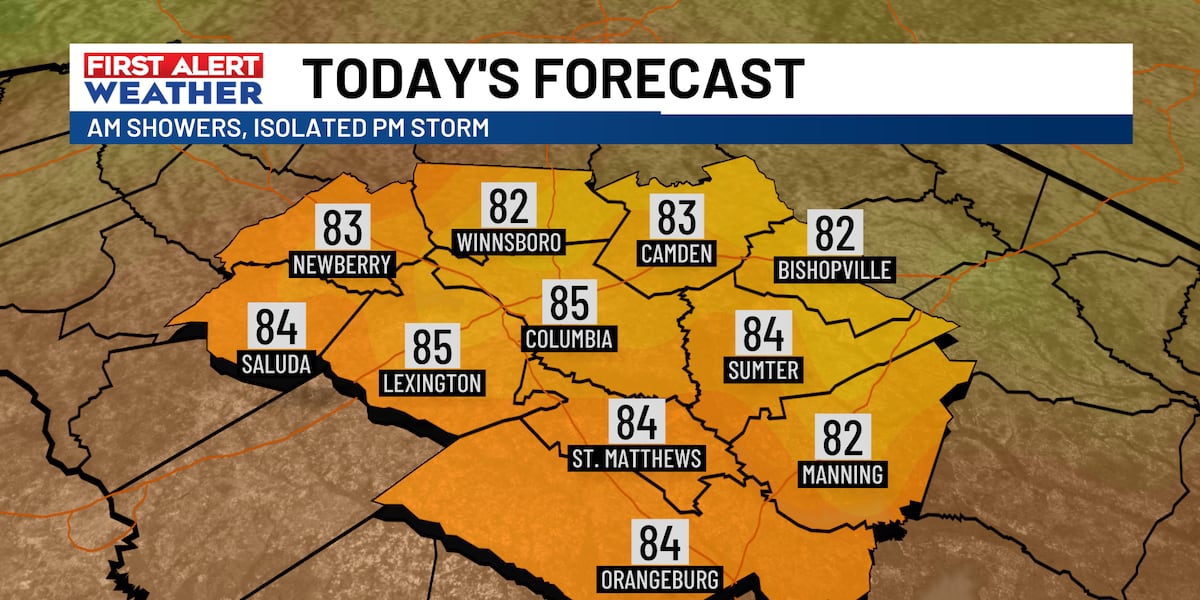
COLUMBIA, S.C. (WIS) - This morning, we’re waking up to a batch of showers moving eastward across the Midlands. The rain exits the Midlands by mid to late morning with just an isolated storm chance later this afternoon. Most areas can expect to stay dry this afternoon. wis (wis) First Alert Headlines: Showers in the morning, then a few pop-up storms for the afternoon into this evening possible. Dry air arrives Sunday and cools us off a bit too. Highs soar through the 80s again next week. First Alert Weather Summary: An upper level disturbance ahead of our next front is bringing showers to the Midlands early this morning. The showers move out before lunchtime, leaving us with just a slight chance for an isolated storm or two late today as a front approaches the region. A cold front passes through tonight into Sunday. The front brings an end to any rain chances for the remainder of the weekend. wis (wis) wis (wis) wis (wis) Otherwise, today will be warm and humid with highs in the mid 80s. wis (wis) Behind the front, more comfortable and drier air for Sunday. Expect highs to be a little cooler, in the upper 70s with partly cloudy skies. wis (wis) First Alert Forecast: Today: Isolated showers and storms in the morning with a few pop-up storms possible in the afternoon. Chance of rain 30%. Highs in the mid-80s. Tonight: Just a stray storm possible early. Lows in the low 60s. Sunday: Partly cloudy with drier air. Highs in the upper-70s. Monday: Cooler start in the 50s. Partly cloudy skies. Highs around 80 degrees. Tuesday: Sun and clouds with more humidity. Highs are in the low-mid 80s. wis (wis) Feel more informed, prepared, and connected with WIS. For more free content like this, subscribe to our email newsletter, and download our apps. Have feedback that can help us improve? Click here. Copyright 2025 WIS. All rights reserved.